Comparative statistics of precipitation levels in our country and in the world as a whole show that we experience rain and snow much less frequently and their intensity is lower than in many other regions of the globe. However, even despite this, Russia’s water resources in terms of volume are one of the first in the world. This is due, first of all, to the fact that our country occupies a vast territory, the area of which is at least fifteen percent of the entire land surface on the planet. Russia's water resources are, first of all, numerous rivers crossing the country's territory, as well as groundwater, no less numerous lakes and glaciers.
Distribution of precipitation by climatic zones
Our country includes several climatic zones, in which the amount of annual precipitation can vary greatly. Zones with excess moisture are located mostly in the north. There, the precipitation level reaches 700 mm per year, which significantly exceeds the natural volume of moisture evaporation from the surface. Many of these areas require dehumidification procedures. Zones with sufficient moisture are in balance between the amount of precipitation and evaporation. This is approximately 500-600 mm throughout the year. Such areas are usually occupied by forests and steppes.
Zones with unstable moisture, on the contrary, receive too little precipitation to compensate high level evaporation of moisture from the soil. These are mainly the southern regions of the country. The level of precipitation here ranges from 300 to 500 mm per year. At the same time, the zones of unstable moisture in our country are much better populated and developed than the rest. Unfortunately, most of the areas suitable for agriculture are located in such zones. Therefore, they require additional irrigation.
The most important component water resources of Russia – rivers. Center state territory Russia was determined by the headwaters of the rivers, the area of the territory. – their mouths, settlement – the direction of river basins. Rivers have influenced our history in many ways. On the river, the Russian man came to life. During the migration, the river showed him the way. For a significant part of the year she fed. For a merchant it is a summer and winter road.
The Dnieper and Volkhov, Klyazma, Oka, Volga, Neva, and many other rivers went down in Russian history as places of the most important events in the life of the country. It is no coincidence that rivers occupy a prominent place in Russian epic.
On geographical map Russia's attention is drawn to its extensive river network.
In Russia there are 120 thousand rivers over 10 km long, including more than 3 thousand medium (200-500 km) and large (more than 500 km). The annual river flow is 4270 km3 (including in the Yenisei basin - 630, Lena - 532, Ob - 404, Amur - 344, Volga River - 254). The generic river flow is taken as the initial value when assessing the country's water availability.
Reservoirs have been created on many rivers, some of which are larger in area than large lakes.
Russia's huge hydropower resources (320 million kW) are also unevenly distributed. More than 80% of the hydropower potential is located in the Asian part of the country.
In addition to the function of storing water for the operation of hydroelectric power stations, reservoirs are used for watering land, water supply to the population and industrial enterprises, shipping, timber rafting, flood control, and recreation. Large reservoirs change natural conditions: they regulate river flow, influence climate, fish spawning conditions, etc.
Russian lakes, of which there are more than 2 million, contain over half of the country's total fresh water. At the same time, Baikal contains about 95% of Russia’s lake water. There are relatively few large lakes in the country, only 9 of them (excluding the Caspian) have an area of more than 1 thousand km2 - Baikal, Ladoga, Onega, Taimyr, Khanka, Chudsko-Pskovskoye, Chany, Ilmen, Beloe. Navigation is established on large lakes, their water is used for water supply and irrigation. Some of the lakes are rich in fish, have reserves of salts and healing mud, and are used for recreation.
Swamps are common on plains in areas of excess moisture and permafrost. In the tundra zone, for example, the swampiness of the territory reaches 50%. Severe swampiness is characteristic of the taiga. The swamps of the forest zone are rich in peat. The best quality peat – low-ash and high-calorie – is produced by raised bogs located on watersheds. Swamps are the source of food for many rivers and lakes. The most swampy region in the world is Western Siberia. Here, swamps occupy almost 3 million km2, and more than 1/4 of the world's peat reserves are concentrated in them.
Groundwater is of great economic importance. It is an important source of nutrition for rivers, lakes and swamps. The groundwater of the first aquifer from the surface is called groundwater. From depth, abundance and quality groundwater soil formation processes and the associated development of vegetation cover depend. When moving from north to south, the depth of groundwater increases, its temperature rises, and mineralization increases.
The groundwater- a source of clean water. They are much better protected from pollution than surface waters. Increasing the content of the series chemical elements and compounds in groundwater leads to the formation of mineral waters. About 300 springs are known in Russia, 3/4 of which are located in the European part of the country ( Mineral water, Sochi, North Ossetia, Pskov region, Udmurtia, etc.).
Almost 1/4 of Russia's fresh water reserves located in glaciers occupying about 60 thousand km2. These are mainly cover glaciers of the Arctic islands (55.5 thousand km2, water reserves 16.3 thousand km3).
Large areas in our country are occupied by permafrost - rock strata containing ice that does not thaw for a long time - about 11 million km2. These are the territories east of the Yenisei, the north of the East European Plain and the West Siberian Lowland. The maximum thickness of permafrost is in the north of Central Siberia and in the lowlands of the Yana, Indigirka and Kolyma river basins. Permafrost has a significant impact on economic life. The shallow occurrence of the frozen layer impairs the formation of the root system of plants and reduces the productivity of meadows and forests. The laying of roads and the construction of buildings change the thermal regime of permafrost and can lead to subsidence, sloughing, swelling of soil, distortions of buildings, etc.
The territory of Russia is washed by the waters of 12 seas: 3 seas of the Atlantic Ocean, 6 seas of the Arctic Ocean, 3 seas of the Pacific Ocean.
The Atlantic Ocean approaches the territory of Russia with its inland seas - the Baltic, Black and Azov. They are highly desalinated and quite warm. These are important transport routes from Russia to Western Europe and other parts of the world. A significant part of the coast of these seas is a recreational zone. Fishing value is low.
The seas of the Arctic Ocean seem to “overlap” the Arctic coast of Russia over a vast area - 10 thousand km. They are shallow and covered with ice most of the year (except for the southwestern part of the Barents Sea). The main transport routes pass through the White and Barents Seas. The Northern Sea Route is important.
Oil and gas deposits on the shelf are promising. The Barents Sea is of greatest commercial importance.
Pacific Seas- the largest and deepest of those washing Russia. The southernmost of them, Japan, is the richest in biological resources and is widely used for international shipping.
Which can be used in economic activities.
The total volume of static water resources in Russia is estimated at approximately 88.9 thousand km 3 of fresh water, of which a significant part is concentrated in groundwater, lakes and glaciers, the estimated share of which is 31%, 30% and 17%, respectively. The share of Russian static fresh water reserves in global resources is on average about 20% (excluding glaciers and groundwater). Depending on the type of water sources, this indicator varies from 0.1% (for glaciers) to 30% (for lakes).
Dynamic reserves of water resources in Russia amount to 4,258.6 km 3 per year (more than 10% of the world figure), which makes Russia the second country in the world in terms of gross volume of water resources after Brazil.
At the same time, in terms of water resource availability, Russia ranks 28th in the world ().
Russia has significant water resources and annually uses no more than 2% of their dynamic reserves; At the same time, a number of regions are experiencing water shortages, which is mainly due to the uneven distribution of water resources throughout the country - the most developed areas of the European part of Russia, where more than 80% of the population is concentrated, account for no more than 10–15% of water resources.
Rivers
Over 90% of rivers belong to the basins of the Arctic and Pacific oceans; 10% - to the Atlantic Ocean basin (Baltic and Azov-Black Sea basins) and closed inland basins, the largest of which is the Caspian Sea basin. At the same time, about 87% of the population of Russia lives in the regions belonging to the basins of the Caspian Sea and the Atlantic Ocean and the bulk of the economic infrastructure, industrial production capacities and productive agricultural land are concentrated.
The length of the vast majority of Russian rivers does not exceed 100 km; a significant part of them are rivers less than 10 km long. They represent about 95% of the more than 8 million km of the Russian river network. Small rivers and streams are the main element of the channel network of drainage areas. Up to 44% of the Russian population lives in their basins, including almost 90% of the rural population.
The average long-term river flow of Russian rivers is 4258.6 km 3 per year, most of this volume is formed in the territory Russian Federation and only a small part comes from the territory of neighboring states. River flow is distributed unevenly across Russian regions - the average annual figure varies from 0.83 km 3 per year in the Republic of Crimea to 930.2 km 3 per year in the Krasnoyarsk Territory.
The average in Russia is 0.49 km/km 2, while the spread of values this indicator uneven for different regions– from 0.02 km/km 2 in the Republic of Crimea to 6.75 km/km 2 in the Altai Republic.
A peculiarity of the structure of the Russian river network is the predominantly meridional direction of flow of most rivers.
The largest rivers in Russia
The question of which river is the largest in Russia can be answered in different ways - it all depends on what indicator is used to compare. The main indicators of rivers are basin area, length, average long-term flow. It is also possible to compare using indicators such as the density of the river network of the basin and others.
The largest water systems in Russia by basin area are the systems of the Ob, Yenisei, Lena, Amur and Volga; the total area of the basins of these rivers is over 11 million km 2 (including the foreign parts of the Ob, Yenisei, Amur and, slightly, Volga basins).
About 96% of all lake water reserves are concentrated in the eight largest lakes of Russia (excluding the Caspian Sea), of which 95.2% is in Lake Baikal.
The largest lakes in Russia
When determining which lake is the largest, it is important to determine the indicator by which the comparison will be made.The main indicators of lakes are surface area and basin area, average and maximum depths, water volume, salinity, altitude, etc.The undisputed leader in most indicators (area, volume, basin area) is the Caspian Sea.
The largest mirror area is in the Caspian Sea (390,000 km2), Baikal (31,500 km2), Lake Ladoga (18,300 km2), Lake Onega (9,720 km2) and Lake Taimyr (4,560 km2).
The largest lakes by drainage area are the Caspian (3,100,000 km2), Baikal (571,000 km2), Ladoga (282,700 km2), Uvs-Nur on the border of Mongolia and Russia (71,100 km2) and Vuoksa (68,500 km 2).
The deepest lake not only in Russia, but also in the world is Baikal (1642 m). Next come the Caspian Sea (1025 m), lakes Khantayskoe (420 m), Koltsevoe (369 m) and Tserik-Kol (368 m).
The deepest lakes are the Caspian (78,200 km 3), Baikal (23,615 km 3), Ladoga (838 km 3), Onega (295 km 3) and Khantayskoye (82 km 3).
The saltiest lake in Russia is Elton (water mineralization in the lake in autumn reaches 525‰, which is 1.5 times more than the mineralization of the Dead Sea) in the Volgograd region.
Lakes Baikal, Lake Teletskoye and Uvs-Nur are included in the UNESCO World Natural Heritage List. In 2008, Lake Baikal was recognized as one of the seven wonders of Russia.
Reservoirs
On the territory of Russia, there are about 2,700 reservoirs in operation with a capacity of over 1 million m 3 with a total useful volume of 342 km 3, and more than 90% of their number are reservoirs with a capacity of over 10 million m 3.
The main purposes of using reservoirs:
- water supply;
- Agriculture;
- energy;
- water transport;
- fisheries;
- timber rafting;
- irrigation;
- recreation (rest);
- flood protection;
- watering;
- shipping.
The flow of rivers in the European part of Russia is most strongly regulated by reservoirs, where there is a shortage of water resources in certain periods. For example, the flow of the Ural River is regulated by 68%, the Don by 50%, and the Volga by 40% (reservoirs of the Volga-Kama cascade).
A significant share of regulated flow falls on the rivers of the Asian part of Russia, primarily in Eastern Siberia - Krasnoyarsk Territory and Irkutsk Region (reservoirs of the Angara-Yenisei cascade), as well as Amur region on Far East.
The largest reservoirs in Russia
Due to the fact that the filling of reservoirs seriously depends on seasonal and annual factors, comparison is usually made based on the indicators achieved by the reservoir at (NFL).
The main tasks of reservoirs are the accumulation of water resources and the regulation of river flow, therefore, the important indicators by which the size of reservoirs are determined are full and. You can also compare reservoirs according to such parameters as FSL value, dam height, surface area, length coastline
and others.
The largest reservoirs by full volume are located in the eastern regions of Russia: Bratskoye (169,300 million m3), Zeyaskoye (68,420 million m3), Irkutsk and Krasnoyarsk (63,000 million m3 each) and Ust-Ilimskoye (58,930 million m3) 3).
The largest reservoirs in Russia in terms of useful volume are Bratskoye (48,200 million m3), Kuibyshevskoye (34,600 million m3), Zeyaskoye (32,120 million m3), Irkutsk and Krasnoyarsk (31,500 million m3 each) - also almost all located in the east; The European part of Russia is represented by only one reservoir, the Kuibyshevsky reservoir, located in five regions of the Volga region.
The largest reservoirs by surface area: Irkutsk on the river. Angara (32,966 km 2), Kuibyshevskoye on the river. Volga (6,488 km 2), Bratskoe on the river. Angare (5,470 km 2), Rybinskoye (4,550 km 2) and Volgogradskoye (3,309 km 2) on the river. Volga.
Swamps The swamps are playing important role in the formation of the hydrological regime of rivers. Being a stable source of river nutrition, they regulate floods and floods, extending them in time and height, and within their tracts contribute to the natural purification of river waters from many pollutants. One of important functions
swamps are carbon sequestration: swamps sequester carbon and thus reduce the concentration of carbon dioxide in the atmosphere, weakening the greenhouse effect; Every year, Russian swamps sequester about 16 million tons of carbon. The total area of marshes in Russia is more than 1.5 million km 2, or 9% of the total area. Swamps are distributed unevenly across the country: greatest number swamps are concentrated in the northwestern regions of the European part of Russia and in central regions
West Siberian Plain;
The areas of swamps range from several hectares to thousands of square kilometers. The swamps contain about 3,000 km 3 of static water reserves, and their total average annual flow is estimated at 1,000 km 3 /year.
An important element of swamps is peat - a unique combustible mineral of plant origin, which has... Russia's total peat reserves are about 235 billion tons, or 47% of world reserves.
The largest swamps in Russia
The largest swamp in Russia and one of the largest in the world is the Vasyugan swamp (52,000 km 2), located on the territory of four regions of the Russian Federation. – Salymo-Yugan swamp system (15,000 km 2), Upper Volga wetland complex (2,500 km 2), Selgon-Kharpinsky swamps (1,580 km 2) and Usinsk swamp (1,391 km 2).
The Vasyugan swamp is a candidate for inclusion in the list of UNESCO World Natural Heritage sites.
Glaciers
The total number of glaciers in the Russian Federation is over 8 thousand, the area of island and mountain glaciers is about 60 thousand km 2, water reserves are estimated at 13.6 thousand km 3, which makes glaciers one of the largest accumulators of water resources in the country.
In addition, large reserves of fresh water are preserved in the Arctic ice, but their volumes are constantly decreasing and, according to recent estimates, this strategic fresh water reserve may disappear by 2030.
Most of Russia's glaciers are represented by the ice sheets of the islands and archipelagos of the Arctic Ocean - about 99% of Russia's glacial water resources are concentrated in them. Mountain glaciers account for slightly more than 1% of the glacial water supply.
The share of glacial feeding in the total flow of rivers originating from glaciers reaches 50% of the annual volume; The average long-term glacial runoff feeding the rivers is estimated at 110 km 3 /year.
Glacial systems of Russia
In terms of glaciation area, the largest are the mountain glacial systems of Kamchatka (905 km 2), the Caucasus (853.6 km 2), Altai (820 km 2), the Koryak Highlands (303.5 km 2) and the Suntar-Khayata ridge (201.6 km 2).
The largest reserves of fresh water are contained in the mountain glacial systems of the Caucasus and Kamchatka (50 km 3 each), Altai (35 km 3), Eastern Sayan (31.8 km 3) and the Suntar-Khayata ridge (12 km 3).
The groundwater
Groundwater accounts for a significant portion of fresh water reserves in Russia. In conditions of increasing deterioration in the quality of surface waters, fresh groundwater is often the only source of providing the population with high-quality drinking water, protected from pollution.
Natural groundwater reserves in Russia are about 28 thousand km 3 ; forecast resources, according to state monitoring of the state of the subsoil, are about 869,055 thousand m 3 /day - from approximately 1,330 thousand m 3 /day in the Crimean to 250,902 thousand m 3 /day in the Siberian Federal District.
The average provision of predicted groundwater resources in Russia is 6 m 3 /day per person.
HYDRAULIC SYSTEMS AND STRUCTURES
Hydraulic structures (HTS) are structures for the use of water resources, as well as for combating the negative effects of water. Dams, canals, dikes, shipping locks, tunnels, etc. GTS make up a significant part of the water management complex of the Russian Federation.
In Russia there are about 65 thousand hydraulic structures of water management, fuel and energy complexes and transport infrastructure.
To redistribute river flow from areas with excess river flow to areas with deficit, 37 large water management systems were created (the volume of transferred flow is about 17 billion m 3 /year); To regulate river flow, about 30 thousand reservoirs and ponds with a total capacity of more than 800 billion m 3 were built; To protect settlements, economic facilities and agricultural lands, over 10 thousand km of protective water barrier dams and shafts were built.
The reclamation and water management complex of federal property includes more than 60 thousand various hydraulic structures, including over 230 reservoirs, more than 2 thousand regulating waterworks, about 50 thousand km of water supply and discharge canals, over 3 thousand km of protective shafts and dams .
Transport hydrosystems include more than 300 navigable hydraulic structures located on inland waterways and are federally owned.
Russia's hydraulic structures are under the jurisdiction of the Federal Agency for Water Resources, the Ministry Agriculture Russian Federation, Ministry of Transport of the Russian Federation, constituent entities of the Russian Federation. Some of the hydraulic structures are privately owned, over 6 thousand are ownerless.
Channels
Artificial riverbeds and canals are an important part of the water system of the Russian Federation. The main tasks of canals are flow redistribution, navigation, irrigation and others.
Almost all operating shipping canals in Russia are located in the European part and, with some exceptions, are part of the Unified Deep-Water System of the European part of the country. Some canals have historically been combined into waterways, for example, the Volga-Baltic and North Dvina, consisting of natural (rivers and lakes) and artificial (canals and reservoirs) waterways. There are also sea canals created to reduce the length of sea roads, reduce the risks and dangers of navigation, and increase the passability of seas..
for Russian agriculture, since arable land is located mainly in the steppe and forest-steppe zones, where agricultural yields fluctuate sharply from year to year depending on weather conditions and only 35% of arable land is in favorable conditions for moisture supply.
The largest channels in Russia
The largest waterways in Russia: the Volga-Baltic waterway (861 km), which includes, in addition to natural routes, the Belozersky, Onega bypass, Vytegorsky and Ladoga canals; White Sea-Baltic Canal (227 km), Volga-Caspian Canal (188 km), Moscow Canal (128 km), North Dvina Waterway (127 km), including Toporninsky, Kuzminsky, Kishemsky and Vazerinsky canals;
Volga-Don Canal (101 km). The longest economic canals in Russia that abstract water directly from water bodies (rivers, lakes, reservoirs): North Crimean Canal - , - a legal act regulating relations in the field of water use. In accordance with Article 2 of the Water Code, water legislation in Russia consists of the Code itself, other
federal laws
Part of the Russian legal system in the field of use and protection of water bodies are international treaties of Russia and ratified international conventions, such as the Convention on Wetlands (Ramsar, 1971) and the UN Economic Commission for Europe Convention on the Protection and Use of Transboundary Watercourses and International Lakes (Helsinki , 1992).
Water management
The central link in the field of use and protection of water resources is the Ministry of Natural Resources and Ecology of the Russian Federation (Ministry of Natural Resources of Russia), which exercises the authority to develop state policy and legal regulation in the field of water relations in Russia.
Russia's water resources are managed at the federal level by the Federal Agency for Water Resources (Rosvodresursy), which is part of the Russian Ministry of Natural Resources.
The powers of Rosvodresurs to provide public services and manage federal property in the regions are exercised by the agency's territorial divisions - basin water departments (BWU), as well as 51 subordinate institutions. Currently, there are 14 commercial banks operating in Russia, the structure of which includes departments in all regions of the Russian Federation. The exception is the regions of the Crimean Federal District - in accordance with the agreements signed in July - August 2014, part of the powers of Rosvodresursov was transferred to the relevant structures of the Council of Ministers of the Republic of Crimea and the Government of Sevastopol.
Management of regionally owned water resources is carried out by the relevant structures of regional administrations.
Management of federal facilities of the reclamation complex is under the jurisdiction of the Ministry of Agriculture of the Russian Federation (Department of Reclamation), water bodies of transport infrastructure - the Ministry of Transport of the Russian Federation (Federal Agency of Sea and River Transport).
State accounting and monitoring of water resources is carried out by Rosvodresursy; for maintaining the State Water Register - with the participation of the Federal Service for Hydrometeorology and Environmental Monitoring (Roshydromet) and the Federal Agency for Subsoil Use (Rosnedra); for maintaining the Russian Register of Hydraulic Structures - with the participation of the Federal Service for Environmental, Technological and Nuclear Supervision (Rostekhnadzor) and the Federal Service for Supervision of Transport (Rostransnadzor).
Supervision of compliance with legislation regarding the use and protection of water bodies is carried out Federal service in the field of environmental management (Rosprirodnadzor), and hydraulic structures - by Rostechnadzor and Rostransnadzor.
According to Water Code In the Russian Federation, the main unit of the management structure in the field of use and protection of water bodies is the basin districts, however, today the existing structure of Rosvodresurs is organized on an administrative-territorial principle and in many ways does not coincide with the boundaries of the basin districts.
Public policy
The basic principles of state policy in the field of use and protection of water bodies are enshrined in the Water Strategy of the Russian Federation until 2020 and include three key areas:
- guaranteed provision of water resources to the population and economic sectors;
- protection and restoration of water bodies;
- ensuring protection from negative impact water
As part of the implementation of the state water policy, the federal target program “Development of the water management complex of the Russian Federation in 2012–2020” (Federal Target Program “Water of Russia”) was adopted in 2012. The federal target program “Clean Water” for 2011–2017, the federal target program “Development of reclamation of agricultural lands in Russia for 2014–2020”, and target programs in Russian regions were also adopted.
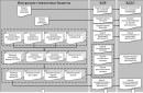
Russia's water resources, like animals, plants, and minerals, are incredibly rich. They are a component of the biosphere and are used by humans in economic (usually recreational) activities.
Types of water resources
There are two large groups of water resources: natural and man-made. The first include:
- oceans (3);
- seas (12);
- rivers (2.5 million);
- lakes (2 million);
- swamps;
- The groundwater;
- glaciers;
- soil moisture.
The second category includes reservoirs specially created for storing large reserves of water.

Rice. 1 Types of water resources
Oceans, seas and rivers
In short, rivers are the basis of Russia’s water potential. Their volume is about 4270 km3. One of the main characteristics of this type of water resources is their unbalanced distribution throughout the country. This is very clearly visible on physical map: in the south and west of the country there are fewer rivers, in the north and in the mountains there is a denser river network. Also characteristic of this type of water resource is the unevenness of its use in different regions states. Since the population density in the European part is higher than in Siberia and the Far East, the use of river resources here is greater. This leads to small rivers disappearing or becoming swamped (drying up), and large rivers gradually becoming polluted.
Oceans, seas and rivers make up the 4 main water basins of our country:
TOP 4 articleswho are reading along with this
- Arctic Ocean basin with seas and rivers (Northern Dvina, Pechora, Ob, Yenisei, Lena, Kolyma);
- Pacific Ocean basin with seas and rivers (Amur, Anadyr);
- Atlantic Ocean basin with seas and rivers (Don, Kuban, Neva);
- Caspian Sea basin with rivers (Volga and Ural).
The use of oceans, seas and rivers is quite clear:
- shipping (example in Russia: Northern Sea Route);
- Oil and gas;
- fishing;
- recreation.
Lakes
More than half of the total useful volume of Russia's water resources (fresh water) is contained in lakes. There are more than 2 million of them in the country. The largest are considered:
- Baikal;
- Ladoga;
- Onega;
- Taimyr;
- Khanka;
- Vats;
- Ilmen;
- White.
Baikal especially stands out in this series. It is this lake that contains more than 90% of all fresh water in the country. It is the most deep lake on the planet, and because of its unique ecosystem it is listed as a UNESCO World Heritage Site.

Rice. 2 Lake Baikal
Lakes, like rivers, provide transport links between populated areas and perform functions such as
- irrigation;
- water supply;
- fisheries;
- medicinal (some lakes contain large amounts healthy salts and mineral mud).
Lakes, as well as rivers, are unevenly distributed throughout Russia. The largest number of them is located in the North-West of the country: the Kola Peninsula, Karelia. Ural, Siberia, Transbaikalia.
The largest reservoirs by surface area: Irkutsk on the river. Angara (32,966 km 2), Kuibyshevskoye on the river. Volga (6,488 km 2), Bratskoe on the river. Angare (5,470 km 2), Rybinskoye (4,550 km 2) and Volgogradskoye (3,309 km 2) on the river. Volga.
Wetlands play an important role in assessing Russia's water resources. They occupy an area of approximately 1.4 ml km2 (most of all in the north-west of the country, in the north of the Central region, in Siberia). The main features of this water resource:
- river feeding;
- cleansing rivers naturally from various pollutants;
- ensuring flood and flood control.
Bogs are also the main source of peat reserves.
In some regions, people purposefully drain swamps, thereby not only harming the river water system, but also destroying entire important ecosystems.
Groundwater, glaciers and soil moisture
Russia has large reserves of groundwater (potential resource - 230 km3 per year with operational reserves of 22 km3 per year). Groundwater is needed for:
- “feeding” or water supply to rivers;
- soil formation;
- providing the population with clean drinking water (it has been proven that groundwater is the cleanest and suitable for consumption even without additional treatment).
The temperature of underground water and the degree of mineralization depend on the depth of occurrence. There are more than 300 mineral springs and more than 30 thermal springs in Russia.
Glaciers are also unique reservoirs of fresh water in Russia. Glaciers include:
- arctic ice (55.5 thousand km2);
- permafrost (rocks containing ice; about 11 ml km2).

Rice. 3 Arctic ice
Soil moisture is also an important (renewable) water resource. Its total volume is 3500 km3 per year.
Reservoirs
Reservoirs are not just additional “reservoirs” of water resources, but also play important functions:
- flood control;
- flood control;
- Creation necessary conditions for recreation and irrigation (necessary to provide for the population and agriculture);
- ensuring the operation of hydroelectric power plants (producing more than 1600 billion kWh of electricity).
The largest number of reservoirs and, as a result, hydroelectric power stations are located in the Eastern regions of the country.
Reservoirs and their operation can lead to an unfavorable ecological state in the region. Deformation of river banks can be observed, landslides occur, and emergency situations arising due to bad general condition waterworks. That is why the work of reservoirs and hydroelectric power stations is closely monitored by special services.
Water resources are not unlimited, although they are renewable. In general, the Russian Federation uses 87.3 km3 of water per year (with total strategic reserves of 97 thousand km3 per year), including 71.0 km3 from surface sources, 11.9 km3 from underground sources and 4.3 km3 of sea water . Every resident of the country uses about 1 m3 of water per year (at the rate of 2.5 -3 liters per day). Also, for each resident of the Russian Federation per year there is an average of 30 thousand m3 of total river flow, 530 m3 of total water intake and 90-95 m3 of domestic water supply (i.e. 250 liters per day).
The protection of water resources is the responsibility of the state, but environmental education of the population also plays an important role in their preservation. Scientists have proven that in Russia, unlike other countries of the world, fresh water is used extremely uneconomically.
What have we learned?
Russia's water supply is one hundred percent. Our country has all types of water resources. They perform both a water-saving function and have specific functionality. Different types of water resources are concentrated in different regions of our country.
Test on the topic
Evaluation of the report
Average rating: 4.4. Total ratings received: 270.
Looking at our planet from the heights of outer space, a comparison immediately arises with a blue ball, which is completely covered with water. At this time, the continents seem to be small islands in this endless ocean. This is quite natural, because water occupies 79.8% of the entire surface, and 29.2% falls on land. The water shell of the Earth is called the hydrosphere; its volume is 1.4 billion m3.
Water resources and their purpose
Water resources- These are waters from rivers, lakes, canals, reservoirs, seas and oceans that are suitable for use in agriculture. This also includes groundwater, soil moisture, swamps, glaciers, and atmospheric water vapor.
Water appeared on the planet about 3.5 billion years ago and initially it was in the form of vapors that were released during the degassing of the mantle. Today water is the most important element in the Earth's biosphere, because nothing can replace it. However, recently, water resources have ceased to be considered limited, because scientists have managed desalinate salt water.
Purpose of water resources- support the vital activity of all life on Earth (humans, plants and animals). Water is the basis of all living things and the main supplier of oxygen in the process of photosynthesis. Water also takes part in climate formation - absorbing heat from the atmosphere in order to release it in the future, thereby regulating climate processes.
It would be worth remembering that water sources play an honorable role in the modification of our planet. People have always settled near reservoirs or water sources. Thus, water promotes communication. There is a hypothesis among scientists that if there were no water on Earth, the discovery of America would have been postponed for several centuries. And Australia would still be unknown today.
Types of water resources
As already said water resources- these are all the water reserves on the planet. But on the other hand, water is the most common and most specific compound on Earth, because only it can exist in three states (liquid, gaseous and solid).

The Earth's water resources consist of:
- surface water(oceans, seas, lakes, rivers, swamps) are the most valuable source of fresh water, but the thing is that these objects are distributed quite unevenly over the Earth’s surface. Thus, in the equatorial zone, as well as in the northern part of the temperate zone, water is in excess (25 thousand m 3 per year per person). And the tropical continents, which consist of 1/3 of the land, are very acutely aware of the shortage of water reserves. Based on this situation, their agriculture develops only under the condition of artificial irrigation;
- groundwater;
- reservoirs created artificially by man;
- glaciers and snowfields (frozen water from glaciers in Antarctica, the Arctic and snowy mountain peaks). This is where most of the fresh water is found. However, these reserves are practically unavailable for use. If all the glaciers are distributed over the Earth, then this ice will cover the earth with a ball 53 cm high, and by melting it, we thereby raise the level of the World Ocean by 64 meters;
- moisture what is found in plants and animals;
- vapor state of the atmosphere.
Water consumption
The total volume of the hydrosphere is amazing in its quantity, however, only 2% of this figure is fresh water, moreover, only 0.3% is available for use. Scientists have calculated the freshwater resources that are necessary for all humanity, animals and plants. It turns out that the supply of water resources on the planet is only 2.5% of the required volume of water.

Around the world, about 5 thousand m3 are consumed annually, while more than half of the consumed water is lost irrevocably. In percentage terms, the consumption of water resources will have the following characteristics:
- agriculture - 63%;
- industrial water consumption - 27% of the total;
- municipal needs take 6%;
- reservoirs consume 4%.
Few people know that in order to grow 1 ton of cotton, 10 thousand tons of water are required, 1 ton of wheat requires 1500 tons of water, the production of 1 ton of steel requires 250 tons of water, and 1 ton of paper requires at least 236 thousand tons of water.
A person should consume at least 2.5 liters of water per day, but on average this person spends big city no less than 360 liters per day, since this figure includes all possible uses of water, including watering streets, washing vehicles and even firefighting.
But the consumption of water resources does not end there. This is evidenced, for example, by water transport or the process of breeding both marine and fresh fish. Moreover, for fish breeding you will only need pure water, saturated with oxygen and free of harmful impurities.
A great example of the use of water resources is recreational areas. There is no such person who would not like to relax by a pond, relax, and swim. In the world, almost 90% of recreational areas are located near bodies of water.
The need to protect water resources
Considering the current situation, we can conclude that water requires a protective attitude towards itself. Currently, there are two ways to conserve water resources:
- reduce fresh water consumption;
- creation of modern high quality collectors.

Storing water in reservoirs limits its flow into the world's oceans. Storing water underground helps prevent its evaporation. The construction of canals can easily solve the issue of delivering water without penetrating into the ground. Humanity also thinks about the newest ways irrigation of agricultural land, allowing the area to be moistened using wastewater.
But each of the above methods actually affects the biosphere. The reservoir system, for example, does not allow the formation of fertile silt deposits; canals interfere with the replenishment of groundwater. Therefore, today one of the most effective ways to preserve water resources is purification. Wastewater. Science does not stand still in this regard, and various methods allow you to neutralize or remove up to 96% harmful substances.
Water pollution problem
Population growth, the rise of production and agriculture... These factors contributed to the shortage of fresh water. In addition, the share of polluted water resources is also growing.

Main sources of pollution:
- industrial waste;
- municipal wastewater;
- plums from the fields (meaning when they are oversaturated with chemicals and fertilizers;
- burial of radioactive substances near a body of water;
- wastewater coming from livestock complexes (water is characterized by an excess of biogenic organic matter);
- shipping.
Nature provides for self-purification of water bodies. This happens due to the presence of plankton in the water, ultraviolet rays entering the water, and the sedimentation of insoluble particles. But unfortunately there is much more pollution and nature on its own is not able to cope with such a mass of harmful substances that man and his activities provide to water resources.
Unusual sources of drinking water
Recently, humanity has been thinking about how to use unconventional sources of water resources. Here are the main ones:
- tow icebergs from the Arctic or Antarctica;
- carry out desalination of sea waters (actively used at the moment);
- condense atmospheric water.
 In order to obtain fresh water by desalinating salt water, desalination stations are installed on sea vessels. There are already about hundreds of such units in the whole world. The world's largest producer of such water is Kuwait.
Fresh water has recently acquired the status of a global commodity; it is transported in tankers using long-distance water pipelines. This scheme works successfully in the following areas:
- the Netherlands gets water from Norway;
- Saudi Arabia receives resource from Philippines;
- Singapore imports from Malaysia;
- water is pumped from Greenland and Antarctica to Europe;
- Amazon transports drinking water to Africa.
One of the latest achievements is installations with the help of which heat nuclear reactors It is used simultaneously for desalination of seawater and generation of electricity. At the same time, the price of one liter of water costs little, since the productivity of such installations is quite high. It is recommended to use water that has passed through this route for irrigation.
Reservoirs can also help overcome freshwater shortages by regulating river flow. In total, more than 30 thousand reservoirs have been built in the world. In most countries, there are projects for the redistribution of river flow through its transfer. But most of these programs have been rejected due to environmental concerns.
Water resources of the Russian Federation
Our country has a unique water resource potential. However, their main drawback is their extremely uneven distribution. So, if we compare the Southern and Far Eastern federal districts Russia, then in terms of the size of local water resources they differ from each other by 30 times, and in terms of water supply - by 100 times.
Rivers of Russia
When thinking about the water resources of Russia, first of all, we should note the rivers. Their volume is 4,270 km 3 . There are 4 water basins on the territory of Russia:
- the seas of the Northern and Arctic Oceans, as well as the large rivers flowing into them (Northern Dvina, Pechora, Ob, Yenisei, Lena, Kolyma);
- the Pacific Ocean (Amur and Anadyr);
- seas of the Atlantic Ocean (Don, Kuban, Neva);
- the internal basin of the Caspian Sea and the flowing Volga and Ural.
Since in the central regions the population density is greater than, for example, in Siberia, this leads to the disappearance of small rivers and water pollution in general.
Lakes and swamps of Russia
Half of all fresh water in the country comes from lakes. Their number in the country is approximately 2 million. Of these, the largest ones are:
- Baikal;
- Ladoga;
- Onega;
- Taimyr;
- Khanka;
- Vats;
- Ilmen;
- White.
A special place should be given to Lake Baikal, because 90% of our fresh water reserves are concentrated in it. In addition to the fact that this lake is the deepest on earth, it is also characterized by a unique ecosystem. Baikal is also included in the UNESCO natural heritage list.

Lakes of the Russian Federation are used for irrigation and as sources for water supply. Some of the listed lakes have a decent supply of medicinal mud and therefore are used for recreational purposes. Just like rivers, lakes are characterized by their uneven distribution. They are mainly concentrated in the Northwestern part of the country (Kola Peninsula and the Republic of Karelia), the Ural region, Siberia and Transbaikalia.
The swamps of Russia also play an important role, although many people treat them with disrespect by draining them. Such actions lead to the death of entire huge ecosystems, and as a result, rivers do not have the opportunity to cleanse themselves naturally. Swamps also feed rivers and act as their controlled object during floods and floods. And of course, swamps are a source of peat reserves.

These elements of water resources are widespread in the North-West and North-Central part of Siberia; the total area of swamps in Russia is 1.4 million km 2.
As we see, Russia has great water resource potential, but we should not forget about the balanced use of this resource and treat it with care, because anthropogenic factors and huge consumption lead to pollution and depletion of water resources.
Stay up to date with everyone important events United Traders - subscribe to our