Ural mountains located between the West Siberian and East European Plains. Their area is 781,000 sq. kilometers. Many travelers dream of getting to this wonder of nature in order to see with their own eyes all the splendor of the famous mountain range. Also, tourists want to know the name of the highest peak of the Urals in order to climb it or appreciate the full power of the Urals at the foot of this mountain.
Mount Narodnaya is the most high point Ural. Its height is 1895 meters. The mountain is located on the territory of the Khanty-Mansiysk Autonomous Okrug and belongs to mountain system called the Subpolar Urals.

origin of name
There are two pronunciations for this name. In the first case, the stress is placed on the first syllable - Folk. The thing is that this mountain is located near the Národa River, whose name sounds in the Komi language as "People-Iz".
But in the days of the USSR, this name was very consonant with popular communist slogans. At every step they talked about the party and the people, so it was decided to rearrange the emphasis on the second syllable, making this peak the socialist heritage of the Soviet people.

In scientific and reference publications, different variants of stress are indicated. A 1958 geography textbook lists a name that correlates with the name of the river. And in the book of 1954 there is evidence that "Narodnaya" is the only correct pronunciation.
Modern scholars believe that the stress should be placed on the first syllable. This is the official pronunciation of the name.

Summit history
In 2016, scientists found that for the first time this peak was marked on maps in 1846 by a geographer from Hungary named Antal Reguli. Antal researched the history of the Mansi peoples, trying to understand the origin of their language. Later, the scientist proved that the Hungarian and Mansi languages have common roots.
Antal Reguli explored the high peak and gave it the original Mansi name Poen-Urr, which means "crown" in translation.
Five years later, an expedition led by E. Hoffmann was sent to this peak. As a result, data were obtained on the geographical position of the mountain and its features.

For a long time, it was believed in scientific circles that this peak was discovered not by Antal Reguli in the 19th century, but by the explorer A. Aleshkov with his expedition in 1927. New data was released only in 2016.
Despite this, Aleshkov's expedition played a very important role. After all, it was he who measured the height of Mount Narodnaya, after which the peak officially became the highest point of the Urals.

It should be noted that when visually assessing the height of mountain peaks, it is difficult to understand which of them is higher. Mount Monarga stands out for its size. It was she who was considered for a long time the highest point of the Urals. But after Aleshkov's research, all the data were carefully checked. In scientific works, it was indicated that not the Monarga, but the People's Peak is a giant mountain. She is 200 meters taller than her neighbor.

Summit climate
Narodnaya Peak is covered with glaciers. It is located in the cold climate zone. Long frosty winters prevail in these parts. The average air temperature during the cold period is -20 degrees Celsius.
Strong snowstorms and freezing rains are frequent guests of these places. AT summer time the temperature rarely rises above 10 degrees.

If you want to conquer the top of the Urals, be prepared for harsh climatic conditions. Even experienced travelers will find it difficult to resist the vagaries of nature. Therefore, it is better to take a reliable guide with you.
The best time to climb the mountain is July and August. During this period there are no snowstorms, and the sun is shining.

Geographical position
This giant is located between two mountains, which are named after the famous explorers of the Urals - Didkovsky and Karpinsky. The most picturesque view of Narodnaya opens from the top of Mount Karpinsky.
The majestic stone slopes covered with snow-white glaciers attract the attention of tourists. And the highest point of Mount Narodnaya is shrouded in clouds.

This peak is located in a deserted area. There are no settlements nearby.
Blue Lake is located next to the mountain giant. Travelers who go hiking in the Urals often set up their camps on the banks of this picturesque reservoir. Its height above sea level is quite high - 1133 meters.

Tourism and Peak Narodnaya
Due to the flourishing of tourism in the second half of the 20th century, the Urals became a destination for many Soviet travelers. Mount Narodnaya was no exception.
Every fan of extreme sports in the depths of his soul dreamed of visiting the highest point of the Ural Mountains. Therefore, over time, commemorative plaques began to be located around the top. Students tried to record their feat, so they brought souvenirs and flags to the top of the mountain giant.
In 1998, the Russian Church installed on the main peak Orthodox cross. A year later, a religious procession took place on the slopes.

So from the wild inhospitable mountain Narodnaya turned into a hospitable giant.
Posted Sun, 08/01/2017 - 10:13 by Cap
Part of the Ural Mountains from the Kosvinsky Kamen massif in the south to the banks of the Shchugor River in the north is called the Northern Urals. In this place, the width of the Ural Range is 50-60 kilometers. As a result of the uplift of ancient mountains and the impact of subsequent glaciations and modern frosty weathering, the territory has a mid-mountain relief, with flat tops.
The Northern Urals is very popular with tourists. Of particular interest are the rocks and remains of the Man-Pupu-Nier, Torre-Porre-Iz, and Muning-Tump massifs. Away from the watershed ridge are the main peaks of this part of the Urals: Konzhakovsky Kamen (1569 meters), Denezhkin Kamen (1492 meters), Chistop (1292), Otorten (1182), Kozhim-Iz (1195), .jpg)
The northernmost peak of the Ural mountain system is Mount Telposiz in Komi. The object is located on the territory of the republic. Mount Telposis in Komi is composed of quartzite sandstones, schists and conglomerates. On the slopes of Mount Telposiz in Komi, a taiga forest grows - mountain tundra. Translated from the language of the local population, the oronym means ""Nest of the winds"".
The subpolar Urals is one of the most beautiful regions of our Motherland. Its ridges stretched in a wide arc from the sources of the Khulga River in the north to Mount Telposiz in the south. The area of the mountainous part of the region is about 32,000 km2.
The unexplored harsh nature, the abundance of fish in rivers and lakes, berries and mushrooms in the taiga attract travelers here. Good communications along the North railway, on steamships and boats along the Pechora, Usa, Ob, Severnaya Sosva and Lyapin, as well as a network of airlines, make it possible to develop water, foot-water, foot and ski routes in the Subpolar Urals with the intersection of the Ural Range or along its western and eastern slopes.
A characteristic feature of the relief of the Subpolar Urals is the high height of the ridges with alpine landforms, the asymmetry of its slopes, the deep dissection of through transverse valleys and gorges, and the significant height of the passes. The highest peaks are located in the center of the Subpolar Urals.
The absolute height of the passes through the main watershed separating Europe from Asia, and through the ridges located to the west of it, is from 600 to 1500 m above sea level. The relative heights of the peaks near the passes are 300-1000 m. The passes on the Sablinsky and Unapproachable ridges are especially high and difficult to overcome, the slopes of which end in steep-walled cairns. The most easily passable passes through the Research Ridge (from 600 to 750 m above sea level) with relatively gentle, insignificant rises that make it easy to carry out portages are located in the southern part of the ridge between the upper reaches of the Puiva (right tributary of the Schekurya) and Torgovoi (right tributary of the Shchugor), as well as between the upper reaches of the Shchekurya, Manya (Lyapin basin) and Bolshoi Patok (right tributary of the Shchugor).
In the area of Mount Narodnaya and on the Narodno-Itinsky ridge, the height of the passes is 900-1200 m, but even here many of them pass through paths along which portages from the upper reaches of the Khulga (Lyapin), Khaimayu, Grubeya, Khalmeryu, Narody to the upper reaches of the tributaries of the Lemva are relatively easy , on Kozhim and Balbanyo (Usa basin).
The subpolar Urals is one of the most beautiful regions of our Motherland. Its ridges stretched in a wide arc from the sources of the Khulga River in the north to Mount Telposiz in the south. The area of the mountainous part of the region is about 32,000 km2.
northern border
From the border of the Perm region to the east along the northern borders of blocks 1-5 of the forestry of the state industrial farm "Denezhkin Kamen" (Sverdlovsk region) to the northeast corner of block 5.
Eastern border
From the northeast corner of the 5 to the south along the eastern borders of blocks 5, 19, 33 to the southeast corner of the square. 33, further east along the northern border of the square. 56 to its southeast corner, further south along the eastern border of sq. 56 to its southeastern corner, further east along the northern border of the square. 73 to its northeastern corner, further south along the eastern border of quarters 73, 88, 103 to the B. Kosva river and further along the left bank of the river. B. Kosva to its confluence with the Shegultan River, then along the left bank of the river. Shegultan to the eastern border of the square. 172 and further south along the eastern borders of quarters 172, 187 to the southeast corner of the quarter. 187, further east along the northern border of the square. 204 to its northeast corner.
Further south along the eastern borders of blocks 204, 220, 237, 253, 270, 286, 303, 319 to the southeast corner of the block. 319, further east along the northern border of quarters 336, 337 to the northeast corner of the quarter. 337.
Further south along the eastern border of blocks 337, 349, 369, 381, 401, 414, 434, 446, 469, 491, 510 to the southeast corner of the block. 510.
southern border
From the southwest corner of the 447 to the east along the southern borders of blocks 447, 470, 471, 492, 493 to the Sosva River, further along the right bank of the river. Sosva to the southeast corner of the square. 510.
Western border
From the southwest corner of the 447 to the north along the border of the Perm region to the northwestern corner of the square. 1 forestry of the state industrial enterprise "Denezhkin Kamen".
Geographical coordinates
Center: lat - 60o30"29.71", lon - 59o29"35.60"
North: lat - 60o47"24.30", lon - 59o35"0.10"
East: lat - 60o26"51.17", lon - 59o42"32.68"
South: lat - 60o19"15.99", lon - 59o32"45.14"
West: lat - 60o22"56.30", lon - 59o12"6.02"
GEOLOGY
The Ilmenogorsk complex is located in the southern part of the Sysert-Ilmenogorsk anticlinorium of the East Ural uplift, has a fold-block structure and is composed of igneous and metamorphic rocks of various compositions. Of greatest interest here are numerous unique pegmat veins, in which topaz, aquamarine, phenakite, zircon, sapphire, tourmaline, amazonite, and various rare-metal minerals are found. Here, for the first time in the world, 16 minerals were discovered - ilmenite, ilmenorutil, potassium sadanagaite (potassium ferrisadanagaite), cancrinite, makarochkinite, monazite-(Ce), polyakovite-(Ce), samarskite-(Y), bindite, ushkovite, fergusonite-beta-(Ce ), fluoromagnesioarfvedsonite, fluororichterite, chiolite, chevkinite-(Ce), aeschinite-(Ce).
Ilmensky Reserve.jpg)
GEOGRAPHY
The relief of the western part is low-mountainous. The average heights of the ridges (Ilmensky and Ishkulsky) are 400-450 m above sea level, the maximum elevation is 747 m. The eastern foothills are formed by low elevations. More than 80% of the area is occupied by forests, about 6% by meadows and steppes. The tops of the mountains are covered with larch-pine forests. Pine forests predominate in the south, while pine-birch and birch forests predominate in the north. On the western slopes of the Ilmensky mountains there is an array of old pine forests. There are areas of larch forests, stony, grass-forb and shrub steppes, moss swamps with cranberries and wild rosemary. More than 1200 species of plants, many endemic, relict and rare species. Ermine, forest ferret, Siberian weasel, wolf, lynx, flying squirrel, hares - hare and hare live, a brown bear comes in. Elk and roe deer are not numerous. Sika deer and beaver are acclimatized. Of the birds, grouse are common - capercaillie, black grouse, hazel grouse, gray partridge. Whooper swan and gray crane nest in the reserve, rare birds are noted - white-tailed eagle, imperial eagle, peregrine falcon, osprey, saker falcon, little bustard.
Since 1930, there has been a mineralogical museum founded by A.E. Fersman, which presents more than 200 different minerals found in the Ilmensky Range, including topazes, corundums, amazonites, etc.
In 1991, a branch was organized - the historical and landscape archaeological monument "Arkaim" with an area of 3.8 thousand hectares. It is located in the steppe foothills of the eastern Urals, in the Karagan valley. More than 50 archaeological monuments are preserved here: Mesolithic and Neolithic sites, burial grounds, Bronze Age settlements, and other historical objects. Of particular importance is the fortified settlement of Arkaim in the 17th-16th centuries. BC e.
Location:
Gremyachinsky district of the Perm Territory.
Monument type: Geomorphological.
Brief description: Weathering remnants in the Lower Carboniferous quartzite sandstones.
Status: Landscape monument of nature of regional importance.
A city turned to stone.
The city is located on the main peak of the Rudyansky Spoy ridge, the absolute height of which is 526 m above sea level. It is a powerful rocky massif composed of fine-grained quartz sandstones of the Lower Carboniferous, which are part of the coal-bearing strata formed in the delta of a large river.
The massif is cut by deep, up to 8–12 m, cracks from 1 to 8 m wide both in the meridional and latitudinal directions, which creates the illusion of deep and narrow perpendicularly intersecting streets, alleys and lanes of an ancient abandoned city.
The Urals is a mountainous country that stretches from north to south from the shores of the icy Kara Sea to the Central Asian steppes and semi-deserts. The Ural Mountains are the natural border between Europe and Asia.
In the north, the Urals ends with a low Pai-Khoi ridge, in the south - with the Mugodzhary mountain range. The total length of the Urals with Pai-Khoi and Mugodzhary is more than 2500 km.
In the east of the Orenburg Region, the Guberlinsky Mountains (the southern part of the Ural Mountains) rise - one of the most beautiful places Orenburg region. The Guberlinsky Mountains are located 30-40 kilometers west of the city of Orsk on the right bank of the Urals, where the Guberlya River flows into it.
The Guberlinskie mountains represent a blurred edge of the high Orskaya steppe, strongly dissected and indented by the valley of the Guberli river, logs and gorges of its tributaries. Therefore, the mountains do not rise above the steppe, but lie below it.
They occupy a narrow strip along the valley of the Ural River, moving to the north into the high Orsk steppe, and to the west, on the right bank of the Guberli, they are replaced by a ridge low-mountain relief. The gentle eastern slope of the Guberlinsky Mountains imperceptibly passes into the plain, on which the city of Novotroitsk is located.
The territory occupied by the Guberlinsky mountains is about 400 square kilometers.
“From the open cracks of the clefts, an incessantly thin vapor rises, trembling against the sun, which is impossible to touch with a hand; the birch bark thrown there or dry chips in one minute ignited with a flame; in bad weather and on dark nights, it seems like a red flame or a fiery vapor several arshins high, ”wrote academician and traveler Pyotr Simon Pallas more than 200 years ago about an unusual mountain in Bashkiria.
A long time ago, Mount Yangantau was called differently: Karagosh-Tau or Berkutova Mountain. According to the good old tradition, "what I see, I call it." In order for the mountain to be renamed, some exceptional event had to occur. They say that this event even has exact date: 1758 Lightning struck the mountain, all the trees and bushes on the southern slope caught fire. Since then, the mountain has become known under the name of Yangantau (Yangan-tau), translated from the Bashkir as “burnt mountain”. The Russians changed the name slightly: Burnt Mountain. However, despite the wide popularity and absolute uniqueness of Yangantau, locals they still remember the old name, Karagosh-tau, and still use it.
Hiking on Iremel can be carried out from May to October from the village of Tyulyuk (Chelyabinsk region). It can be reached from the railway station Vyazovaya (70 km).
The road to Tyulyuk is covered with gravel, asphalt to Meseda. There is a bus.

Tyulyuk - view of the Zigalga ridge 
The base camp can be set up both in Tyulyuk, there are special paid places for tents or houses to choose from, and on the road to Iremel near the Karagayka river.
_____________________________________________________________________________________
SOURCE OF MATERIALS AND PHOTO:
Team Nomads.
Encyclopedia of the Urals
List of mountains and ranges of the Urals.
Mountains and peaks of the Urals.
- 67015 views
Basic moments
This mountain system itself, which not only separates both continents, but is also an officially delineated cordon between them, belongs to Europe: the border is usually drawn along the eastern foot of the mountains. Formed as a result of the collision of the Eurasian and African lithospheric plates, the Ural Mountains cover a vast territory. It includes the expanses of the Sverdlovsk, Orenburg and Tyumen regions, the Perm Territory, Bashkortostan and the Komi Republic, as well as the Aktobe and Kustanai regions of Kazakhstan.
In terms of its height, which does not exceed 1895 meters, the mountain system is significantly inferior to such giants as the Himalayas and the Pamirs. For example, the peaks of the polar Urals are average in terms of level - 600-800 meters, not to mention the fact that they are also the narrowest in terms of the width of the ridge. However, there is a definite plus in such geological characteristics: they remain accessible to humans. And this is not so much about scientific research, but about the tourist attractiveness of the places through which they run. The landscape of the Ural Mountains is truly unique. Here, crystal clear mountain streams and rivers begin their run, growing into larger reservoirs. Such large rivers as the Ural, Kama, Pechora, Chusovaya and Belaya also flow here.
For tourists, a wide variety of recreational opportunities open up here: both for real extreme sportsmen and for beginners. And the Ural Mountains are a true treasure trove of minerals. In addition to deposits of coal, natural gas and oil, mines are being developed here, in which copper, nickel, chromium, titanium, gold, silver, and platinum are mined. If we recall the tales of Pavel Bazhov, the Ural zone is also rich in malachite. And also - emerald, diamond, crystal, amethyst, jasper and other precious stones.
The atmosphere of the Ural Mountains, regardless of whether you visit the Northern or Southern Urals, Subpolar or Middle, is indescribable. And their greatness, beauty, harmony and the purest air energize and positive, inspire and, of course, leave vivid impressions for the rest of your life.
History of the Ural Mountains
The Ural Mountains have been known since ancient times. In sources that have survived to this day, they are associated with the Hyperborean and Riphean mountains. So, Ptolemy pointed out that this mountain system consists of the Rhymnus mountains (this is the current Middle Ural), Noros (Southern Urals) and the northern part - the Hyperborean Mountains proper. In the first written sources of the 11th century AD, it was called the “Earth Belt” because of its great length.
In the first Russian chronicle, The Tale of Bygone Years, which dates back to the same 11th century, the Ural Mountains were called by our compatriots Siberian, Belt or Big Stone. Entitled " Big Stone"They were also applied to the first map of the Russian state, also known as the" Big Drawing ", published in the second half of the 16th century. Cartographers of those years depicted the Urals as a mountain belt, from where many rivers originate.
There are many versions of the origin of the name of this mountain system. E. K. Hoffman, who developed the so-called Mansi version of this toponym, compares the name "Ural" with the Mansi word "ur", which translates as "mountain". The second point of view, also very common, is the borrowing of the name from the Bashkir language. She, according to many scientists, seems to be the most convincing. After all, if we take the language, legends and traditions of this people - for example, the famous epic "Ural-Batyr" - then it is easy to make sure that this place name has not only existed in them since ancient times, but has been maintained from generation to generation.
Nature and climate
The natural landscape of the Ural Mountains is incredibly beautiful and multifaceted. Here you can not only look at the mountains themselves, but also go down into numerous caves, swim in the waters of local lakes, get a portion of thrills while rafting on turbulent rivers. Moreover, each tourist chooses for himself how to travel. Some people like independent trips with a backpack on their shoulders, others prefer the more comfortable conditions of a sightseeing bus or the interior of a personal car.
The fauna of the "Earth Belt" is no less diverse. The dominant position in the local fauna is occupied by forest animals, the habitat of which is coniferous, broad-leaved or mixed forests. So, squirrels live in coniferous forests, the basis of their diet is spruce seeds, and in winter these pretty animals with a fluffy tail feed on pre-stocked pine nuts and dried mushrooms. The marten is widespread in local forests, the existence of which is difficult to imagine without the already mentioned squirrel, for which this predator hunts.
But the real wealth of these places is the fur trade animal, the fame of which extends far beyond the region, for example, the sable that lives in the forests of the Northern Urals. True, it differs from the dark Siberian sable in a less beautiful reddish skin. Uncontrolled hunting for a valuable furry animal is prohibited at the legislative level. Without this ban, it would certainly have been completely destroyed by now.
The taiga forests of the Ural Mountains are also inhabited by the traditional Russian wolf, bear and elk. Roe deer are found in mixed forests. On the plains adjacent to the mountain ranges, the hare and the fox feel at ease. We did not make a reservation: they live precisely on the flat terrain, and the forest for them is just a shelter. And, of course, the crowns of trees are well inhabited by many species of birds.
As for the climate of the Ural Mountains, the geographical position plays an important role in this regard. In the north, this mountain system goes beyond the Arctic Circle, but most of the mountains are located in the temperate climate zone. If you move from north to south along the perimeter of the mountain system, you can notice how the temperature indicators gradually increase, which is especially noticeable in the summer. If in the north during the warm season the thermometer shows from +10 to +12 degrees, then in the south - from 20 to 22 degrees above zero. However, in winter, the temperature difference between north and south is not so sharp. The average monthly temperature in January in the north is 20 degrees with a minus sign, in the south 16-18 degrees below zero.
Air masses moving from the Atlantic Ocean also have a significant impact on the climate of the Urals. And although as atmospheric flows move from the west towards the Urals, the air becomes less humid, you cannot call it 100% dry either. As a result, more precipitation - 600-800 millimeters per year - falls on the western slope, while on the eastern slope this figure varies between 400-500 mm. But the eastern slopes of the Ural Mountains in winter fall under the power of a powerful Siberian anticyclone, while in the south, during the cold season, cloudy and cold weather sets in.
A tangible influence on local climate fluctuations is also exerted by such a factor as the topography of the mountain system. As you climb the mountain, you will feel that the weather is getting harsher. Different temperatures are felt even on different slopes, including those located in the neighborhood. Different areas of the Ural Mountains are also characterized by uneven amounts of precipitation.
Sights of the Ural Mountains
One of the most famous protected areas of the Ural Mountains is the Deer Streams park, located in the Sverdlovsk region. Curious tourists, especially interested in ancient history, make a "pilgrimage" to the Pisanitsa rock located here, on the surface of which drawings made by ancient artists are applied. Of considerable interest are the caves and the Big Failure. Deer Streams has a fairly developed tourist infrastructure: special trails are equipped in the park, there are viewing platforms not to mention places to stay. There are also rope crossings.
If you are familiar with the work of the writer Pavel Bazhov, his famous "Malachite Box", then you will certainly be interested in visiting the natural park "Bazhovskie Places". Opportunities for proper rest and relaxation are simply magnificent. You can make walks on foot, as well as cycling and horseback riding. Walking along specially designed and thought-out routes, you will take in picturesque landscapes, climb Mount Markov Stone and visit Lake Talkov Stone. Thrill-seekers usually flock here in the summer to raft down mountain rivers in canoes and kayaks. Travelers come here in winter, enjoying snowmobiling.
If you appreciate the natural beauty of semi-precious stones - it is natural, not subject to processing - be sure to visit the Rezhevskaya reserve, which combines deposits of not only precious, but also semi-precious and ornamental stones. Traveling to the mining sites on your own is prohibited - you must be accompanied by an employee of the reserve, but this in no way affects the impressions of what you see. The Rezh River flows through the territory of Rezhevsky, it was formed as a result of the confluence of the Big Sap and Ayati - rivers originating in the Ural Mountains. Shaitan-stone, popular among travelers, is located on the right bank of the Rezhi. The Urals consider this stone to be the focus of mystical natural forces that help in various life situations. You can believe it or not, but the flow of tourists who come to the stone with various requests to higher powers does not dry out.
Of course, the Urals attract like a magnet fans of extreme tourism who enjoy visiting its caves, of which there are a huge number. The most famous are Shulgan-Tash, or Kapova, and the Kungur Ice Cave. The length of the latter is almost 6 km, of which only one and a half kilometers are accessible to tourists. On the territory of the ice cave Kungura there are 50 grottoes, over 60 lakes and countless stalactites and stalagmites. The temperature in the cave is always sub-zero, so for visits here, dress as you would for a winter walk. The visual effect of the splendor of its interior decoration is enhanced by special lighting. But in the Kapova cave, researchers discovered rock paintings, whose age is estimated at 14 or more thousand years. Approximately 200 works of ancient masters of the brush have become the property of our time, although there must have been more of them. Travelers can also admire the underground lakes and visit the grottoes, galleries and numerous halls located on three levels.
If the caves of the Ural Mountains create a winter atmosphere at any time of the year, then some sights are best visited in winter. One of them is an ice fountain, which is located in national park"Zyuratkul" and arose thanks to the efforts of geologists who drilled a well in this place. Moreover, this is not just a fountain in the usual “urban” sense for us, but a fountain of groundwater. With the onset of winter, it freezes and turns into a voluminous icicle of a bizarre shape, which is also impressive with its 14-meter height.
Many Russians, in order to improve their health, go to foreign thermal springs, for example, to the Czech Karlovy Vary or the Gellert baths in Budapest. But why rush beyond the cordon if our native Ural is also rich in thermal springs? To complete a full course of healing procedures, it is enough to come to Tyumen. Hot springs here are rich in trace elements useful for human health, and the water temperature in them ranges from +36 to +45 degrees Celsius, depending on the season. We add that modern recreation centers are built on these sources. mineral waters are also treated in the Ust-Kachka recreation complex, located not far from Perm and with a unique chemical composition their waters. Summer recreation here can be combined with boating and catamarans.
Despite the fact that waterfalls are not so typical for the Ural Mountains, they are present here and attract the attention of tourists. Among them, one can single out the Plakun waterfall, located on the right bank of the Sylva River. It overthrows fresh water from a height exceeding 7 m. Its other name is Ilyinsky, it is given by local residents and visitors who consider this source to be holy. There is also a waterfall near Yekaterinburg, named for its roaring "temper" Grokhotun. Its peculiarity is that it is man-made. He throws his waters down from more than 5 meters high. When the summer heat sets in, visitors are happy to stand under its jets, cooling off and receiving hydromassage, and completely free of charge.
Video: South Ural
Major cities of the Urals
Millionth Yekaterinburg, the administrative center of the Sverdlovsk region, is called the capital of the Urals. It is also, unofficially, the third capital of Russia after Moscow and St. Petersburg and the third capital of Russian rock. This is a large industrial metropolis, especially charming in winter. He is generously covered with snow, under the cover of which he resembles a giant who has fallen asleep in a deep sleep, and you never know exactly when he will wake up. But when you get enough sleep, then, do not hesitate, it will definitely unfold to its full potential.
Yekaterinburg usually makes a strong impression on its guests - first of all, with many architectural sights. Among them, one can single out the famous Temple-on-the-Blood, erected on the site of the execution of the last Russian emperor and his family, the Sverdlovsk rock club, the building of the former District Court, museums of various subjects and even an unusual monument to ... an ordinary computer keyboard. The capital of the Urals is also famous for its shortest subway in the world, listed in the Guinness Book of Records: 7 stations account for only 9 km.
Chelyabinsk and Nizhny Tagil also gained wide popularity in Russia, and primarily thanks to the popular comedy show Our Russia. The characters of the program, beloved by the audience, are, of course, fictitious, but tourists are still interested in where to find Ivan Dulin, the world's first gay miller, and Vovan and Gena, Russian tourists who are unlucky and drink-loving, constantly getting into frankly tragicomic situations. One of the visiting cards of Chelyabinsk are two monuments: Love, executed in the form of an iron tree, and Lefty with a savvy flea. Impressive in the city is the panorama of local factories located above the Miass River. But in the Nizhny Tagil Museum of Fine Arts you can see a painting by Raphael - the only one in our country that can be found outside the Hermitage.
Another city in the Urals that has become famous thanks to television is Perm. It is here that the “real boys” live, who became the heroes of the series of the same name. Perm claims to be the next cultural capital of Russia, and this idea is actively lobbied by designer Artemy Lebedev, who is working on appearance city, and gallery owner Marat Gelman, who specializes in contemporary art.
The real historical treasure of the Urals and all of Russia is also Orenburg, which is called the land of endless steppes. At one time, he survived the siege of the troops of Emelyan Pugachev, its streets and walls remember the visits of Alexander Sergeevich Pushkin, Taras Grigorievich Shevchenko and the wedding of the first cosmonaut of the Earth Yuri Alekseevich Gagarin.
In Ufa, another city in the Urals, there is a symbolic sign "Kilometer Zero". The local post office is the very point from which the distance to other points of our planet is measured. Another well-known attraction of the capital of Bashkortostan is the Ufa bronze sign, which is a disk with a diameter of one and a half meters and weighing a whole ton. And in this city - at least, so the locals assure - there is the highest equestrian statue on the European continent. This is a monument to Salavat Yulaev, who is also called the Bashkir Bronze Horseman. The horse, on which this associate of Emelyan Pugacheva sits, towers over the Belaya River.
Ski resorts in the Urals
The most important ski resorts of the Urals are concentrated in three regions of our country: the Sverdlovsk and Chelyabinsk regions, as well as in Bashkortostan. Zavyalikha, Bannoe and Abzakovo are the most famous of them. The first one is located near the city of Trekhgorny, the last two are located near Magnitogorsk. According to the results of the competition, which is held within the framework of the International Congress of the Ski Industry, Abzakovo was recognized as the best ski resort in the Russian Federation in the 2005-2006 season.
A whole scattering of ski resorts is also concentrated in the regions of the Middle and Southern Urals. Thrill-seekers and just curious tourists who want to try themselves in such an “adrenaline” sport as skiing come here almost all year round. Travelers here are waiting for good tracks for skiing, as well as for sledding and snowboarding.
In addition to skiing, descents along mountain rivers are very popular among travelers. Fans of such alloys, which also increase the level of adrenaline, go for thrills to Miass, Magnitogorsk, Asha or Kropchaevo. True, it will not be possible to quickly reach your destination, as you will have to travel by train or by car.
The holiday season in the Urals lasts on average from October-November to April. During this period, snowmobiling and quad biking are another popular pastime. In Zavyalikha, which has become one of the most popular tourist destinations, they even installed a special trampoline. On it, experienced athletes work out complex elements and tricks.
How to get there
Getting to all the major Ural cities will not be difficult, so the region of this majestic mountain system is one of the most convenient for domestic tourists. The flight from Moscow will take only three hours, and if you prefer to travel by train, the journey by rail will take a little over a day.
The main Ural city, as we have already said, is Yekaterinburg, located in the Middle Urals. Due to the fact that the Ural Mountains themselves are low, it was possible to lay several transport routes leading to Siberia from Central Russia. In particular, you can travel through the territory of this region along the famous railway artery - the Trans-Siberian Railway.
The Ural Mountains, formed due to the collision of the Eurasian and African lithospheric plates, are a unique natural and geographical object for Russia. They are the only mountain range crossing the country and dividing the state to the European and Asian parts.
In contact with
Geographic location
In which country the Ural Mountains are located, any schoolchild knows. This massif is a chain that is located between the East European and West Siberian plains.
It is stretched so that it divides the largest one into 2 continents: Europe and Asia. Starting from the coast of the Arctic Ocean, ends in the Kazakh desert. It stretches from south to north, and in some places it reaches 2,600 km.
The geographical location of the Ural Mountains passes almost everywhere parallel to the 60th meridian.
If you look at the map, you can see the following: central District located strictly vertically, the northern one turns to the northeast, and the southern one turns to the southwest. Moreover, in this place the ridge merges with nearby hills.
Although the Urals is considered the border between the continents, there is no exact geological line. Therefore, it is considered that they belong to Europe, and the line dividing the mainland runs along the eastern foothills.
Important! The Urals are rich in their natural, historical, cultural and archaeological values.
The structure of the mountain system
In the annals of the 11th century, the Ural mountain system is mentioned as earth belt. This name is due to the length of the ridge. Conventionally, it is divided into 5 regions:
- Polar.
- Subpolar.
- Northern.
- Average.
- South.
The mountain range partially captures the northern districts of Kazakhstan and 7 Russian regions:
- Arkhangelsk region
- Republic of Komi.
- Yamalo-Nenets Autonomous Okrug.
- Perm region.
- Sverdlovsk region.
- Chelyabinsk region.
- Orenburg region.
Attention! The widest part of the mountain range is located in the Southern Urals.

The location of the Ural mountains on the map.
Structure and relief
The first mention and description of the Ural Mountains comes from ancient times, but they were formed much earlier. This happened under the interaction of rocks of various configurations and ages. In some areas, and now preserved remnants of deep faults and elements of oceanic rocks. The system was formed almost at the same time as the Altai, but later it experienced smaller uplifts, resulting in a small "height" of the peaks.
Attention! The advantage over the high Altai is that there are no earthquakes in the Urals, so it is much safer to live in.
Minerals
The long-term resistance of volcanic structures to the force of the wind was the result of the formation of numerous attractions created by nature. These can be attributed caves, grottoes, rocks and so on. In addition, in the mountains there are huge mineral reserves, primarily ore, from which the following chemical elements are obtained:
- Iron.
- Copper.
- Nickel.
- Aluminum.
- Manganese.
Making a description of the Ural Mountains according to physical map, we can conclude that most of the development of minerals is carried out in the southern part of the region, and more precisely in Sverdlovsk, Chelyabinsk and Orenburg regions. Almost all types of ores are mined here, and a deposit of emeralds, gold and platinum has been discovered not far from Alapaevsk and Nizhny Tagil in the Sverdlovsk region.
The region of the lower foredeep of the western slope abounds in oil and gas wells. Northern part The region is somewhat inferior in deposits, but this is offset by the fact that precious metals and stones predominate here.
 Ural mountains - mining leader, ferrous and non-ferrous metallurgy and chemical industry. In addition, the region is in first place in Russia in terms of pollution level.
It should be taken into account, no matter how profitable the development of underground resources is, the harm to the environment is more significant. Raising rocks from the depths of the mine is carried out by crushing with the release of a large amount of dust particles into the atmosphere.
At the top, the fossils enter into a chemical reaction with the environment, the oxidation process takes place, and the chemical products thus obtained again enter the air and water.
Attention! The Ural Mountains are known for their deposits of precious, semi-precious stones and precious metals. Unfortunately, they are almost completely worked out, so the Ural gems and malachite can now only be found in the museum.
Peaks of the Urals
On the topographic map The Russian Ural Mountains are marked in light brown. This means that they do not have large indicators relative to sea level. Among the natural regions, one can emphasize the highest region located in the Subpolar region. The table shows the coordinates of the heights of the Ural Mountains and the exact size of the peaks.

The location of the peaks of the Ural Mountains is created in such a way that there are unique sites in each region of the system. Therefore, all the listed heights are recognized tourist sites successfully used by people leading an active lifestyle.
It can be seen on the map that the Polar region is medium in height and narrow in width.
The nearby Subpolar region has highest altitude, it is characterized by a sharp relief.
Of particular interest arises from the fact that several glaciers are concentrated here, one of which is extended in length by almost 1 000 m.
The height of the Ural Mountains in the Northern region is insignificant. The exceptions are a few peaks that rise above the entire range. The remaining heights, where the vertices are smoothed, and they themselves have a rounded shape, do not exceed 700 m above sea level. Interestingly, closer to the south, they become even lower and practically turn into hills. The terrain is practically resembles a flat.
Attention! The map of the south of the Ural Mountains with peaks over one and a half kilometers again reminds us of the involvement of the ridge in the huge mountain system that separates Asia from Europe!
Big cities
The physical map of the Ural Mountains with the cities marked on it proves that this area is considered to be abundantly populated. An exception can only be called the Polar and Subpolar Urals. Here several cities with a population of one million and a large number of those with more than 100,000 inhabitants.
The population of the region is explained by the fact that at the beginning of the last century there was an urgent need for minerals in the country. This was the reason for the large migration of people to the region, where similar developments were carried out. In addition, in the early 60s and 70s, many young people left for the Urals and Siberia in the hope of radically changing their lives. This influenced the formation of new settlements under construction at the site of mining.
Yekaterinburg
Capital of the Sverdlovsk region with population 1,428,262 people considered the capital of the region. The location of the metropolis is concentrated on the eastern slope of the Middle Urals. The city is the largest cultural, scientific, educational and administrative center. The geographical position of the Ural Mountains is created in such a way that it is here that a natural path lies, connecting Central Russia and Siberia. This influenced the development of infrastructure and the economy of the former Sverdlovsk.
Chelyabinsk
 The population of the city, which is located where the Ural Mountains, according to the geological map, border on Siberia: 1,150,354 people.
It was founded in 1736 on the eastern slope of the South Range. And with the advent of railway communication with Moscow, it began to develop dynamically and turned into one of the largest industrial centers of the country.
Over the past 20 years, the ecology of the region has deteriorated significantly, which has led to an outflow of the population.
Nevertheless, today the volume of local industry is more than 35% of gross municipal product.
Ufa
The capital of the Republic of Bashkortostan with a population of 1,105,657 people is considered 31st city in Europe by population. It is located to the west of the Southern Ural Mountains. The length of the metropolis from south to north is more than 50 km, and from east to west - 30 km. In terms of size, it is one of the five largest Russian cities. In the ratio of the number of population and the occupied area, each inhabitant accounts for about 700 m2 of urban area.
In addition to millionaires, there are cities with a population of less than the indicated number near the Ural Mountains. First of all, you need to name the capitals of administrative centers, which include the following: Orenburg - 564,445 people and Perm - 995,589. In addition to them, you can add some more cities:
- Nizhny Tagil - 355,694.
- Nizhnevartovsk - 270 865.
- Surgut - 306 789.
- Nefteyugansk - 123,567.
- Magnitogorsk - 408 418.
- Chrysostom - 174 572.
- Miass - 151 397.
Important! Information on the number of population is presented as of the end of 2016!
Geology: Ural Mountains
Ural region. Geographical location, main features of nature
Conclusion
Although the height of the Ural Mountains is not great, they are an object close attention from climbers, tourists and just people leading an active lifestyle. Anyone, even the most sophisticated person, can find a hobby here to their liking.
Ural mountains- unique for our country natural object. Probably, it is not necessary to think to answer the question why. The Ural Mountains - the only mountain range that crosses Russia from north to south, is the border between two parts of the world and the two largest parts (macro-regions) of our country - European and Asian.
Geographical position of the Ural Mountains
The Ural Mountains stretch from north to south, mainly along the 60th meridian. In the north they bend towards the northeast, towards the Yamal Peninsula, in the south they turn towards the southwest. One of their features is that the mountainous territory expands as you move from north to south (this can be clearly seen on the map on the right). In the very south, in the region of the Orenburg region, the Ural Mountains connect with nearby elevations, such as General Syrt.
Strange as it may seem, the exact geological boundary of the Ural Mountains (hence the exact geographical boundary between Europe and Asia) still cannot be accurately determined.
The Ural Mountains are conditionally divided into five regions: Polar Urals, Subpolar Urals, Northern Urals, Middle Urals and Southern Urals.
To one degree or another, part of the Ural Mountains is captured by the following regions (from north to south): Arhangelsk region, the Komi Republic, the Yamalo-Nenets Autonomous Okrug, the Khanty-Mansi Autonomous Okrug, the Perm Territory, the Sverdlovsk Region, the Chelyabinsk Region, the Republic of Bashkortostan, the Orenburg Region, and also part of Kazakhstan.
Origin of the Ural Mountains
The Ural Mountains have a long and complex history. It begins back in the Proterozoic era - such an ancient and little-studied stage in the history of our planet that scientists do not even divide it into periods and epochs. Approximately 3.5 billion years ago, on the site of future mountains, a rupture of the earth's crust occurred, which soon reached a depth of more than ten kilometers. Over the course of almost two billion years, this fault widened, so that about 430 million years ago an entire ocean was formed, up to a thousand kilometers wide. However, soon after this, the convergence of lithospheric plates began; the ocean disappeared relatively quickly, and mountains formed in its place. It happened about 300 million years ago - this corresponds to the era of the so-called Hercynian folding.

New large uplifts in the Urals resumed only 30 million years ago, during which the Polar, Subpolar, Northern and Southern parts of the mountains were raised by almost a kilometer, and the Middle Urals by about 300-400 meters.
At present, the Ural Mountains have stabilized - no major movements of the earth's crust are observed here. Nevertheless, they still remind people of their active history to this day: earthquakes happen here from time to time, and very large ones (the strongest had an amplitude of 7 points and was recorded not so long ago - in 1914).
Features of the structure and relief of the Urals
From a geological point of view, the Ural Mountains are very complex. They are formed by the breeds of the most different types and ages. In many ways, the features of the internal structure of the Urals are associated with its history, for example, traces of deep faults and even sections of the oceanic crust are still preserved.
The Ural Mountains are medium and low in height, the highest point is Mount Narodnaya in the Subpolar Urals, reaching 1895 meters. It is curious that the second highest peak of the Urals - Mount Yamantau- located in the South Urals. In general, in profile, the Ural Mountains resemble a depression: the highest ridges are located in the north and south, and the middle part does not exceed 400-500 meters, so that when crossing the Middle Urals, you may not even notice the mountains.

View of the Main Ural Range in the Perm Territory. Author of the photo - Yulia Vandysheva
It can be said that the Ural Mountains were “unlucky” in terms of height: they were formed in the same period as Altai, but subsequently experienced much less strong uplifts. The result - the highest point of Altai, Mount Belukha, reaches four and a half kilometers, and the Ural Mountains are more than two times lower. However, such an "elevated" position of Altai turned into a danger of earthquakes - the Urals in this respect is much safer for life.

Typical vegetation of the mountain tundra belt in the Ural Mountains. The picture was taken on the slope of Mount Humboldt (Main Ural Range, Northern Urals) at an altitude of 1310 meters. Author of the photo - Natalia Shmaenkova
The long, continuous struggle of volcanic forces against the forces of wind and water (in geography, the former are called endogenous, and the latter exogenous) has created a huge number of unique natural attractions in the Urals: rocks, caves and many others.
The Urals is also known for its vast reserves of minerals of all types. These are, first of all, iron, copper, nickel, manganese and many other types of ores, building materials. The Kachkanar iron deposit is one of the largest in the country. Although the metal content in the ore is low, it contains rare, but very valuable metals - manganese, vanadium.
In the north, in the Pechora coal basin, hard coal is mined. There are noble metals in our region - gold, silver, platinum. Undoubtedly, Ural precious and semi-precious stones are widely known: emeralds mined near Yekaterinburg, diamonds, gems of the Murzinskaya strip, and, of course, Ural malachite.
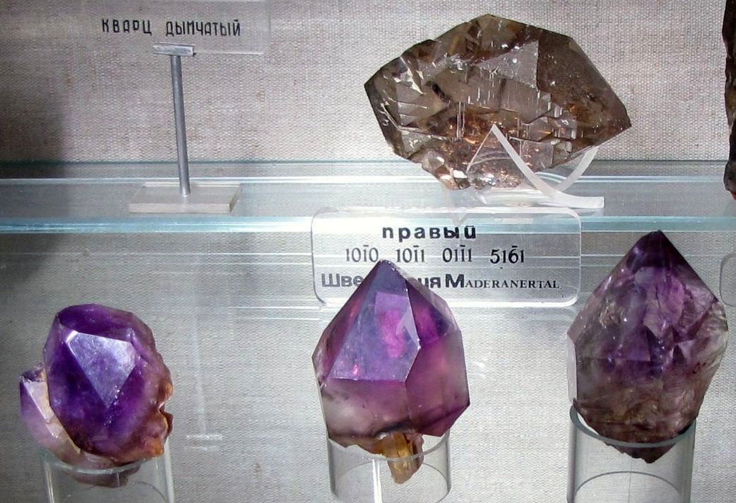
Unfortunately, many valuable old deposits have already been depleted. "Magnetic mountains", containing large reserves of iron ore, have been turned into quarries, and malachite reserves have been preserved only in museums and in the form of separate inclusions at the site of old mines - it is hardly possible to find even a three-hundred-kilogram monolith now. Nevertheless, these minerals largely ensured the economic power and glory of the Urals for centuries.
Text © Pavel Semin, 2011
website
Film about the Ural Mountains: